Tags
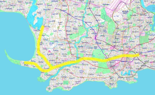
Line 2 of the Metro System serves much of the western part of the city, pretty much heading due west from “Central Station”, splitting in half towards its western end. Here’s a general look at the area of the city it serves:
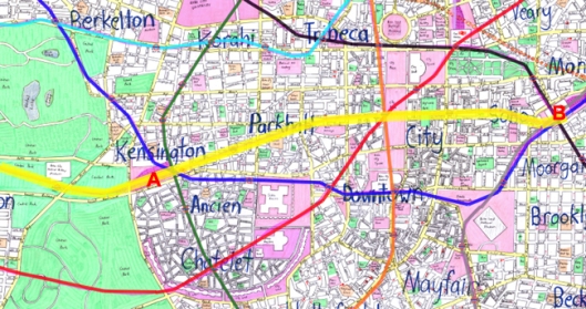
In the central city, the line provides a key connection between two of the main commuter terminals: Kensington Station (A) and Central Station (B). It also connects with a large number of the other metro lines running through the city centre:
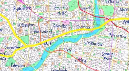
Further out to the west, the line passes through what would seem like fairly dense suburbs along the northern side of the river. You can imagine the line being put through in perhaps the early decades of the 20th century, facilitating the growth of these suburbs, then perhaps in more recent years a spread of employment along the line, perhaps a few high-rise residential buildings in close proximity to stations, taking advantage of the attractiveness of the area:
The more southern of the two branches heads off to serve a coastal residential community (probably similar to Bondi Beach in Sydney), while the more northern route hooks up with “West City”, a major employment hub for the western part of the city (the main connecting hub between the city centre and New Haven further to the west).
Compared to Line 1, Line 2 has different major patronage attractors along its route. There’s a university near its station in West City, there are major beaches that are likely to be flocked on sunny weekends, there’s a major museum not far west of the city centre and of course there are the two commuter rail terminals. That said, I don’t think it’s likely to have quite as high patronage as Line 1 – a commuter rail line would take most of the long-distance passengers from the west (although along a different catchment) while the far west sections of the line are probably not as high density as most of the areas Line 1 passes through. However, it’s still a key line in the Metro system and most probably a very busy one too.
